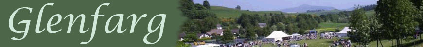
- Home
- Community
- Clubs & Groups
- What'sOn
- Community Council
- Past & Present
- Contacts
The Glenfarg Path Network comprises of four circular walks starting and finishing at the village shop. The routes are suitable for all ages and abilities, and include sections of quiet back roads, pathways or Core Paths.
The shortest of the walks is the Duncrieve Circular (Green Route) which takes about an hour to walk or half an hour to cycle, and is mostly on minor roads or good paths through open countryside, with no steps or stiles, but some fairly steep gradients. The route goes through Wallace Park, Duncrieve Village, over Hilton Hill, and back to the village along the Glendy road, and offers views west over Glenfarg reservoir towards the Turret Hills, as well as elevated views of Glenfarg and views east to the Lomond hills.
The Balcanqhual Circular (Blue Route) is the second shortest of the four circuits and should take about 2 and a halfhours to walk or an hour to cycle. It is mostly on minor roads or good paths through open countryside, with no steps or stiles, but some moderately steep gradients. The route includes the historic sites of Arngask Church and Balvaird Castle as well as fine views of the Lomond Hills and the Howe of Fife.The Balcanqhual Circular (Blue Route) takes in the historic sites of Arngask Church and Balavaird Castle.
Taking 3 and a half hours to walk or 2 hours to cycle, Lochelbank and Dron Hill (Red Route) is the second longest of the four circuits and includes hill tracks and rough terrain as well as some possible gate climbing. There is also a burn crossing on the optional part of the route. The route offers impressive views in all directions from the high points of Cairn Geddes and Dron Hill.
Finally, the Reservoir Circular (Purple Route) is the longest of the four circuits and should take about 4 hours to walk or 2 and a half hours to cycle. The route includes hill tracks and rough and moderately steep terrain. The route traverses around the top end of the reservoir and offers great views in all directions.
A leaflet containing full descriptions of theses walks and a map of the routes is available from the village shop or can be downloaded in pdf form by clicking here.
Disclaimer: The Paths leaflet is just a rough guide. Those who follow these routes must accept responsibility for their own actions and safety. Please ensure you have the necessary fitness and equipment before you set off on any of these walks. The members of Glenfarg Path Network cannot be held responsible for any misfortune suffered by any individual whilst doing these walks. Please follow the Scottish Outdoor Access Code and respect other land users. All the sections of these routes which are not on public highway, follow Core Paths which allows non-motorised public access, however many sections cross agricultural land which may contain livestock or crops. If this is the case, please follow the guidance set out in the Outdoor Access Code.
For further information about Core Paths, or the SOAC please click on the links below.